


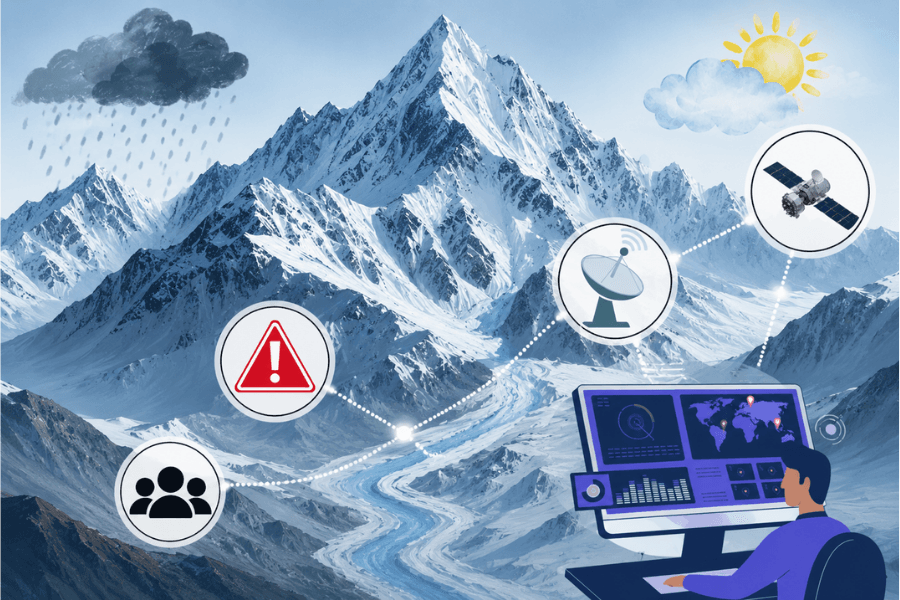
The Western Himalaya is often discussed in terms of individual hazards: a landslide here, a flash flood there, a glacier retreating elsewhere. But the mountain system does not experience these risks separately. Changes in temperature and precipitation affect snow and glaciers; changes in the cryosphere alter the timing and nature of water flows; and steep terrain and fragile geology can turn these shifts into landslides, debris flows, floods and avalanches.
The Chamoli disaster of 2021 showed how these interactions can unfold. A rock–ice avalanche originating in a high-altitude glaciated catchment generated a debris-laden flood that travelled through the Rishi Ganga and Dhauliganga valleys, damaging hydropower infrastructure and causing loss of life. This raises a governance question: if environmental risks propagate across physical systems, sectors and administrative boundaries, can they be managed effectively through institutions organised around those same boundaries?
An Integrated Physical System
The climate of the Western Himalaya is strongly influenced by winter precipitation associated with western disturbances. Snow accumulated at higher elevations melts during spring and early summer, contributing to river discharge in the Indus and upper Ganga basins.
The region is warming at around 0.2–0.3°C per decade, while glaciers are losing roughly 0.3–0.6 metres of water equivalent a year, and snow-cover duration and runoff timing are changing. Rising temperatures can alter snowfall, snowmelt and glacier mass balance, while intense precipitation and unstable terrain can increase the likelihood of landslides and flash floods.
The Western Himalaya is therefore a coupled climate–cryosphere–hydrology–hazard system, in which changes in one part can alter risk elsewhere.
A Fragmented Governance System
India has substantial scientific and institutional capacity across cryosphere research, remote sensing, hydrology, geology, environmental management, infrastructure and disaster management. But these capabilities are distributed across institutions with separate mandates, methodologies and data-sharing arrangements.
The same fragmentation extends to decision-making. Agencies responsible for roads, hydropower, environmental protection, water resources, climate adaptation and disaster management operate through separate institutional channels even where their decisions affect the same landscape.
The problem, then, is not simply whether India possesses sufficient knowledge about Himalayan risks, but whether knowledge generated in different domains is brought together and carried into development decisions.
The Limits of Project-Level Risk Assessment
This fragmentation becomes particularly consequential as roads, tunnels, hydropower projects and tourism infrastructure expand across the Western Himalaya.
Most development decisions are necessarily made project by project. But the risks they create or encounter are not always confined to project boundaries. Roads, tunnels and hydropower infrastructure can affect slopes, drainage, river flows and sediment, while multiple interventions within the same landscape may produce effects that are not visible when each is assessed separately.
The distinction is important. Project-level assessment asks whether an individual intervention creates or faces unacceptable risk. Cumulative assessment asks what happens when that intervention is added to everything already built, approved or planned in the same connected landscape.
The appropriate scale of assessment should therefore follow the geography of the risk. Depending on the processes involved, this may be a catchment, river basin or another connected mountain landscape rather than an individual project site or administrative jurisdiction.
Project-level assessment remains necessary. But it needs to sit within a wider assessment of cumulative risk that brings environmental hazards together with infrastructure and settlement exposure before development decisions are taken.
Building an Integrated Risk Mechanism
Moving from fragmented to cumulative assessment does not require replacing specialised institutions with a single Himalayan authority. It requires connecting the work of institutions that currently observe, assess and manage different parts of the same risk system.
First, meteorological, hydrological, cryospheric and geological observations should be brought together to support a common assessment of interacting hazards. Shared protocols would allow changes in rainfall, snow, glaciers, river flows and slope stability to be interpreted together rather than as separate environmental indicators.
Second, these observations should feed into periodically updated multi-hazard and cumulative-risk assessments at the appropriate spatial scale. Geological investigations, hydrological assessments and climate projections could then be considered alongside existing and planned roads, tunnels, hydropower, settlements and other development.
Third, these assessments must have a defined place in decision-making. They should inform where infrastructure is located, how projects are appraised and designed, and whether additional development could materially increase cumulative risk within a particular landscape. The same evolving assessment should inform forecasting, early warning and disaster preparedness.
The institutional requirement is therefore not another layer of scientific observation, but a way of connecting observation, integrated assessment and decision-making. This requires data sharing, joint risk assessments and coordinated planning among agencies that currently work through separate mandates.
The Western Himalaya will continue to be governed by specialised institutions responsible for different sectors and hazards. That division of responsibility is not itself the problem. The problem arises when it produces divided assessments of a risk system that is physically connected. Institutions need not mirror the mountain system, but the assessment on which their decisions are based must.